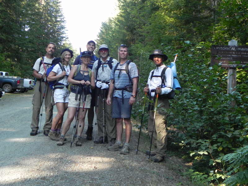
Day-hiking Putvin Trail, Mt Stone (6612 ft). & the Lake of the Angels loop. Hamma Hamma, WA (9-10-2011) ---estimated 10 miles with 5000 ft elev gain
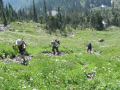
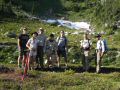
This outing was a last minute trip posted on the Peninsula Wilderness Club (PWC) website that was hosted by the PWC president, Paul Dutky. The PWC members and friend, Tom Henning, Soon Wellner, Shawn Roots, Brian Conley, Aleta, and I participated. A nice summer weather streak has continued yesterday (9-10 consecutive days over 80F !!!) and was the hottest summer weekend so far (83F on Fri, 85F on Sat, & 87F on Sun). There was some concerns of wild fire smokes from the Big Hump fire (Duckabush trail, The Brothers Wilderness) started on 1 Sept that was already burnt near 600 acres as of 8 Sept and is still burning, but the smoke was minimal below 4000 ft elev and no smoke above 4000 ft elev on the south side where the Mt Stone was located. My biggest concern was my physical condition. My legs and shoulders still had some sore and stiff spots from 4 days of backpacking trip (about 44 miles with 10000 ft elev gain) completed just 3.5 days ago. I really wanted to day-hike the Mt Stone where I accidentally almost summit the Mt last year during the Lake of the Angels hike. After all, I did fine and felt strong during the hike.
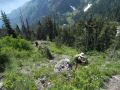
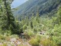
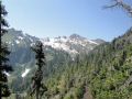
Mt Stone (6612 ft) is located in the south eastern corner of the Olympic National Park. The Lake of the Angels that I hiked last year (10-17-2010)(Click here to see the pictues) nestled just below the Mt Skokomish and left of the Mt Stone. Hiking/backpacking destinations on the Hamma Hamma River Road are Lower/Upper Lena Lakes, Mt Lena, Mt Bretherton, The Brothers MT, the Lake of the Angels, Mt Stone & Mt Skokomish, and Mildred Lakes.
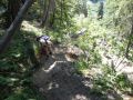
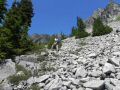
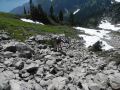
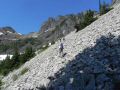
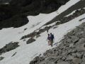
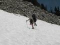
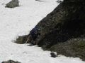
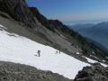
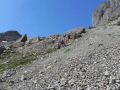
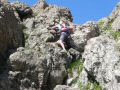
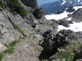
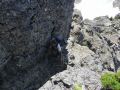
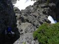
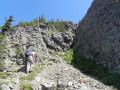
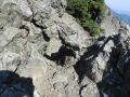
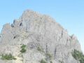
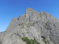
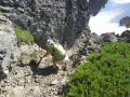
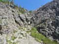
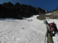
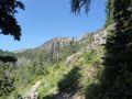
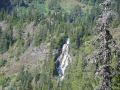
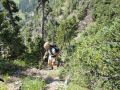
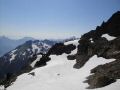
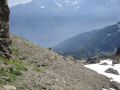
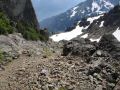
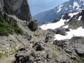
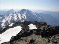
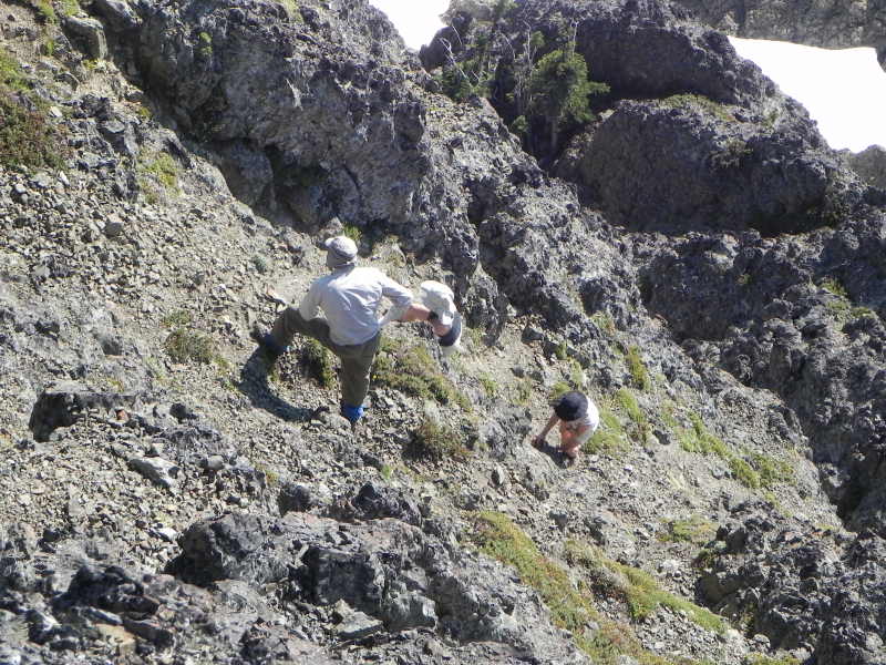
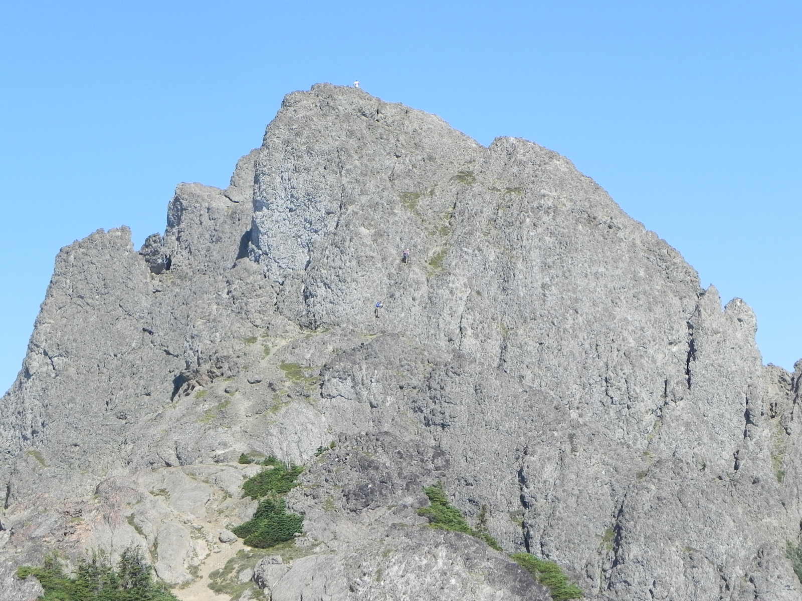
It was about 10 miles roundtrip with 5000 ft elev gain, so it was very steep and strenuous. We scrambled up the two infamous headwalls, passed the pond of false prophet (this was where I took the wrong turn last year), hiked left of the St Peter's Gate, summit the Mt Stone, made a small loop by traversing to the Lake of the Angels, scrambled down the head walls, and back to the Putvin Trailhead. Actually, topping the Mt Stone required a lot of physical strength & condition, good body balance, snow traveling using an ice axe, some height exposure, and decent scrambling skill (easier for the rock climbers). In my opinion, Mt Washington (Hoodsport, WA) scrambling was a little harder (more riskier) but the Mt Stone had steep loose shale, scree, & dirt trails and a bunch of scrambling places (30 ft rock climbing just below the summit !). Mt Stone hike will be added to one of my favorite short hikes list along with Mt Washington and the Mildred Lakes.
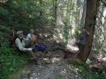
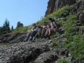
Thanks a lot, Paul, for taking us to the Mt Stone ! The hikers/climbers consisted of different level of expertise from no-experience to decent in scrambling/climbing a mountain. Paul diligently encouraged a couple of novice climbers and patiently helped them summit a mountain. It was quite a bit of work and a monumental achievement of them.
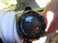
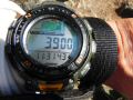
Elevation Summary (Some are estimated but should be close. My altimeter
was off by 160 ft.)
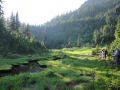
a. Trailhead (1600 ft elev)
b. Clear Treelines (starting
at 3200 ft elev)
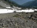
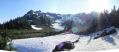
c. Headwalls (3950 ft elev)
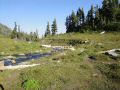
d. Pond of False Prophet
(4400 ft elev)
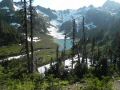
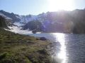
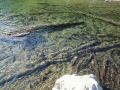
e. Lake of the Angles (4800 ft elev)
f. Mt Stone (6612
ft elev)
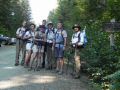
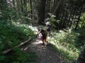
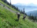
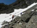
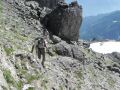
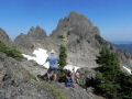
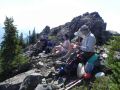
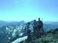
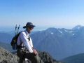
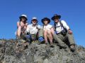
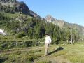
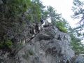
Ready
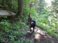
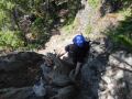
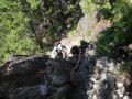
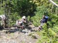
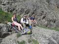
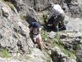
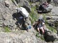
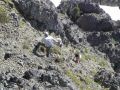
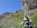
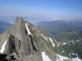
to hike the Putvin Trail, Mt Stone, & the Lake of the Angels ! Paul
is patiently
guiding two novice climbers to the summit.
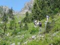
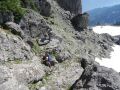
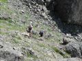
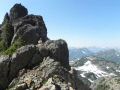
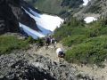
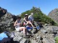
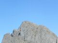
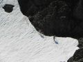
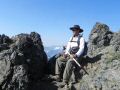
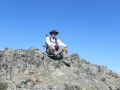
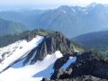
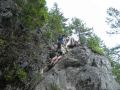
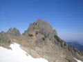
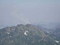
One solo hiker on the Mt Stone summit.
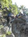
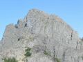
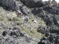
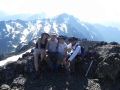
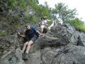
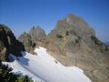
Brian and Tom are scrambling up just below the summit on the 30
ft scramble !!!.
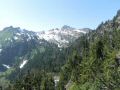
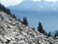
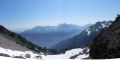
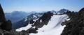
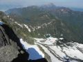
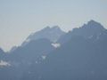
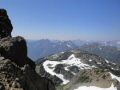
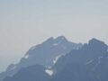
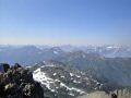
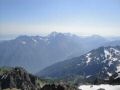
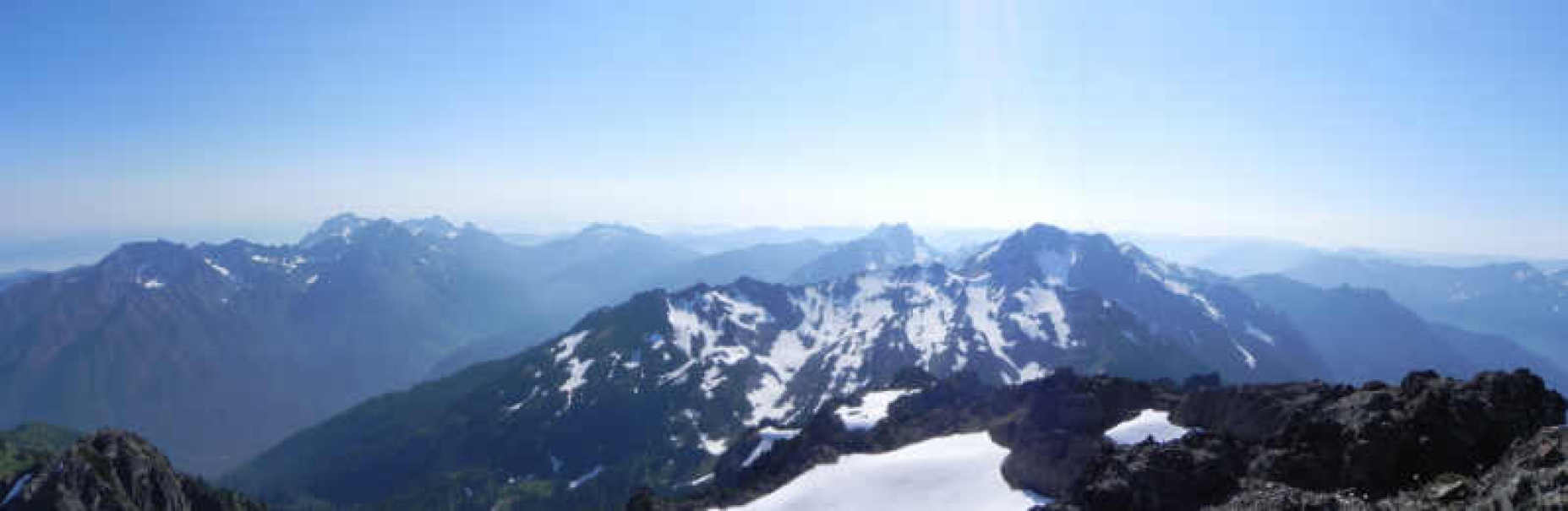
A South Western
view from the Mt Stone summit: Mt Washington, Mt Ellinor, Mt Cruiser,
& Mt Skokomish (Picture quality was terrible. It
was not due to Duckabush smoke. I think it was due to humid weather.)
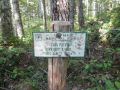
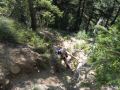
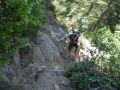
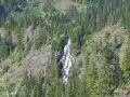
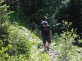
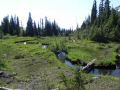
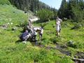
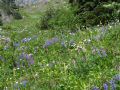
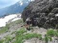
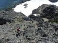
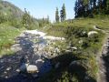
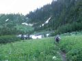
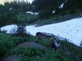
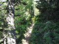
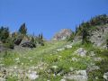
From Trailhead to the Pond of False Prophet (At this junctioin, I took a wrong turn to the Mt Stone last year):
|
|
|
|
|
|
|
|
|
|
|
|
|
|
|
|
|
|
|
|
|
|
|
|
|
|
|
|
|
|
|
|
|
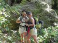
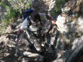
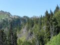
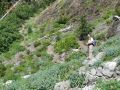
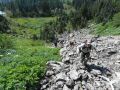
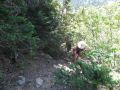
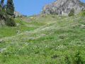
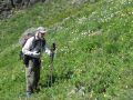
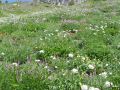
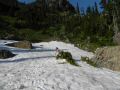
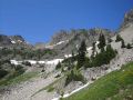
From the Pond of False Prophet to the Mt Stone Summit:
|
|
|
|
|
|
|
|
|
|
|
|
|
|
|
|
|
|
|
|
|
|
|
|
|
|
|
|
|
|
|
|
|
|
|
|
|
|
|
|
|
|
|
|
|
|
|
|
|
|
|
|
|
|
|
|
|
|
|
|
|
|
|
|
|
|
|
|
|
|
|
|
|
|
|
|
|
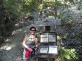
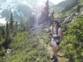
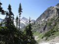
From the Mt Stone Summit to the Lake of the Angels and back to the trailhead:
|
|
|
|
|
|
|
|
|
|
|
|
|
|
|
|
|
|
|
|
|
|
|
|
|
|
|
|
|
|
|
|
|
Pictures from Tom Henning:
|
|
|
|
|
|
|
|
|
|
|
|
|
|
|
|
|
|
|
|
|
|
|
|
|
|
|
|
|
|
|
|
|
Facts about Mt Stone:
Mt. Stone is the highpoint of Mason County (below
Kitsap County where I live). It is one of 11 county highpoints in Washington
that requires over 5,000 feet of elevation gain to reach the summit by the easiest
route. Washington has more county highpoints in this category than any other
lower 48 state. At 2,132 feet of topographic prominence, Mt. Stone is the 118th
most prominent peak in Washington.
Trailhead Direction:
Recommend to use a high clearance vehicle. There
were two washouts that required a high clearance vehicle. Coming from Hoodsport,
just past the town of Hamma Hamma turn left at Hamma Hamma Recreational Area
sign. Follow road for several miles past the trailhead for the Lena Lake (Lower
and Upper Lena Lakes, The Brohters MT, etc). Road will
become gravel and in some places were very bumpy, so take it slow. The Putvin Trail
sign is about 4 miles pass the Lena Lake trailhead (8 miles in), on the right. Hard
to see, so drive fairly slow.