Isaac's Journey
Home Page
Dayhiking the Tyler Peak (6364 ft), Mt Baldy (6827 ft)
(6-26-2011)
(Estimated 8.5 miles with 5200 ft elevation gain)
I heard of this trail as very steep for its mileage but rewarded with fantastic
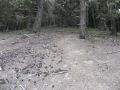
interior views of the Olympics. The area was devastated by the Maynard
Burn in the early 1900s but, since it's over 100 years ago, I did not see any
forest fire reminiscence. The forest fire supposely destroyed the virgin
timber on Maynard Peak, Baldy, Tyler Peak, and Ned Hill.
Last week, a
solo hiker (NWhikers forum) posted an excellent report on a dayhike trip of
the Mt Baldy (6827 ft) and Gray Wolf Peak (7218 ft). Jay and I decided
to hike the area: Tyler Peak and Mt Baldy (return via upper Maynard Burn trail).
Essentially, Jay hosted this trip since he had good knowledge of the trail.
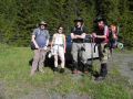
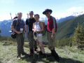
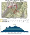
Two other PWC members (Paul and Soon) joined the hike.
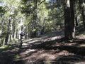
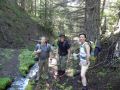
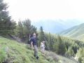
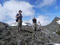
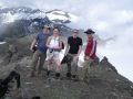
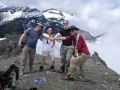
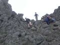
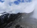
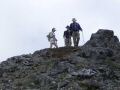
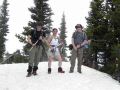
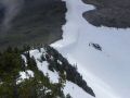
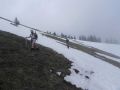
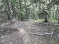
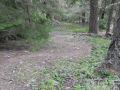
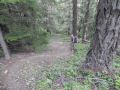
Jay,
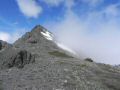
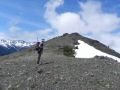
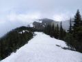
Soon, Paul, and Isaac at the Tyler & Baldy Trailhead. Just
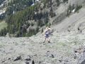
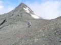
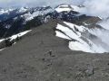
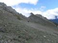
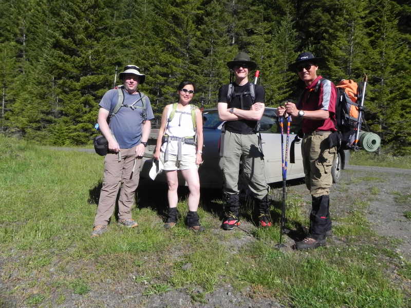
below the Tyler Peak (Clouds are rolling in). Coming
up on the ridge toward Baldy Mt.
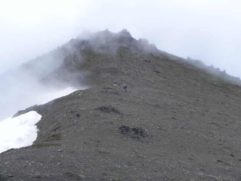

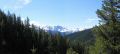
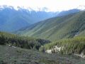
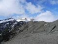
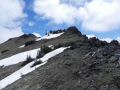
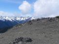
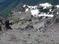
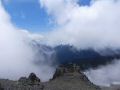
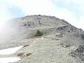
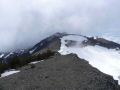
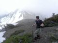
A
spectacular view of the Olympics: Mt Townsend, Mt Constance, Mt
Deception, The Needles, Mt Baldy, etc. The rule is to take
pictures when it's nice. This view was gone in 30 minutes due to
fast moving clouds..
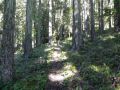
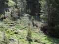
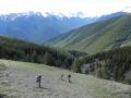
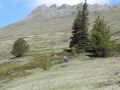
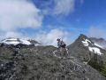
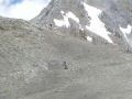
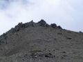
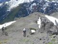
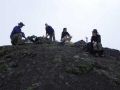
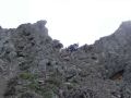
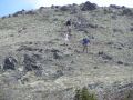
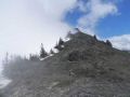
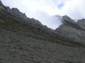
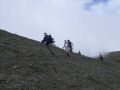
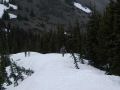
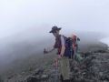
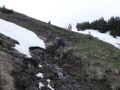
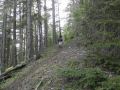
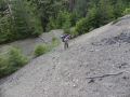
Hiking
up to the Tyler Peak:
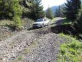
It was a loop hike (Trailhead - Climber's route-
Tyler Peak - craggy ridge - Baldy Mt - Upper Maynard Burn trail - Trailhead).
The loop was estimated at 8.5 miles with 5200 ft elev gain per Paul's
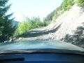
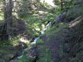
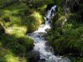
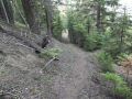
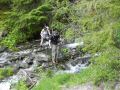
GPS. We hiked up to the Tyler's Peak via Climber's Route. Right
off the trailhead, the trail was steep for one mile or so. Then,
it leveled off. After crossing the Mueller creek, the trail steepened
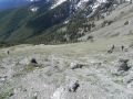
to the Tyler peak. It was basically straight up to the peak. On the way
up to the Tyler peak (6364 ft) beyound 5000 ft elevation, we were rewarded
with the spectacular interior views of the Olympics (Mt Townsend, Mt Constance,
Mt Deception, Royal Creek, The Needles, Peaks around Mt Baldy, etc). Gray
Wolf areas were hidden behind the Mt Baldy and clouds. Also, it
was cloudy to the North (Sequim and Straight of Juan De Fuca).
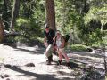
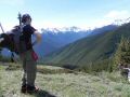
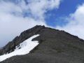
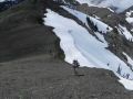
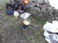
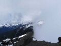
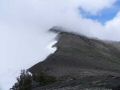
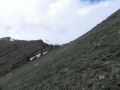
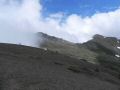
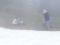
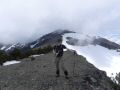
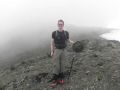
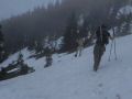
Hiking toward Mt Baldy:
After our relaxing lunch and desert (Ginger
Cookies by Soon), we headed to Mt Baldy along the craggy ridge. Since
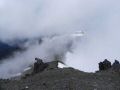
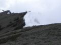
clouds were moving in/out fast and covering the Mt Baldy, we were not planning
to hike up the Mt Baldy if cloudy. When we arrived to the cut off area
(to the Maynard Burn trail), Mt Baldy was somewhat clear and cloudy. Paul
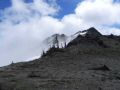
& I decided to hike up and down in 1 hour. We hiked to the false summit
just below the Mt Baldy surrounded by clouds. I was very satisfied to
hike up to the false summit since I just wanted to see the different terrain
just below the Mt Baldy despite the thick clouds.
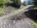
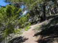
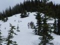
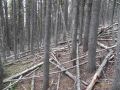
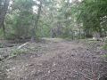
Hiking down the Maynard Burn Trail:
All (Jay, Paul, Soon, &
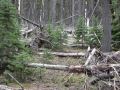
I) of us started coming down toward the Maynard Burn trail. We over
shot a ridge and ended up little further North which was a massive log jam area.
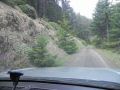
We finally found the trail back and hiked out fast. It was the Upper
Maynard Burn trail. It was indeed very steep all the way down to the old
road.
In overall, it was an excellent day hike for the interior views of the Olympics
mountain ranges from the edge of the Northeast. It was a decent day. It
was only 8.5 miles loop with 5200 ft elev gain but it was tough, certainly not
for a leasurely family hike. For me, this hike was my two consecutive
dayhikes with some weight (20-25LBS) to test out my physical condition for multi-days
backpacking. I felt strong but I still don't know how I will do with multi-days
backpacking. On the coming weekend, Jay and I are planning to do 2 days
of backpacking from Duckabush to Staircase which is about 30 miles with 5500
ft elev gain.
Isaac's Journey
Home Page