|
|
|
|
|
|
|
|
|
|
|
|
|
|
|
|
|
|
|
|
|
|
|
|
|
|
|
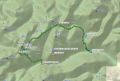
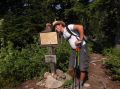
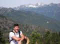
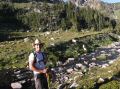
Dayhiking Upper Lena Lake, St Peter's Gate, Mt Stone, and Lake of the Angels Loop (8-17-2012) -16.7 miles with 7200 ft elev gain
After taking off a week from hiking, I was yearning for a good strenuous day-hike. One of my day-hike lists was to hike the Upper Lena Lake, St Peter's Gate, Mt Stone, and Lake of the Angels Loop in SE Olympics. In the SE Olympics area, I hiked the Putven trail to the Lake of the Angles a few times and 2 times to the Upper Lena Lake. I have wanted to connect those two trails as I have heard its way trails from the Upper Lean to above the Scout Lake and the St Peter's Gate. I estimated that it's about 16-17 miles with 6000 ft elev gain since the Mt Stone via the Putven trail was 10 miles roundtrip with 5000 ft elev gain. Well, it turned out to be about 16.7 miles with 7200 ft elev gain that included some routing finding. It was a bit too much in a day. But it was very satisfying to hike and bike the loop in a day.
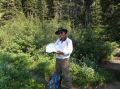
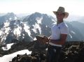
I was fortunate to hike with one of my co-workers. On a week before (on Sunday), he climbed the Brothers' Mt (SE Olympics) with ease, so, I knew that he would be qualified for this tough hike. Indeed, he was not afraid of snow traveling, steep slopes, and easily managed class 2 scrambling with occasional class 3 scrambling to the Mt Stone summit.
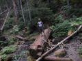
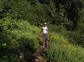
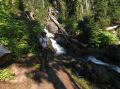
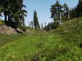
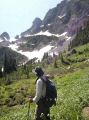
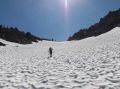
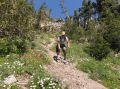
1. Lena Lake Trailhead to Upper Lena Lake (7.3 miles with 3900 ft elev gain):|
|
|
|
|
|
|
|
|
|
|
|
|
|
|
|
|
|
|
|
|
|
|
|
|
|
|
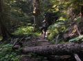
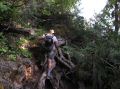
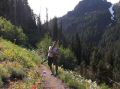
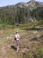
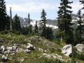
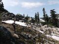
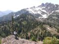
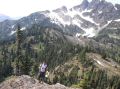
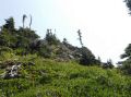
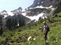
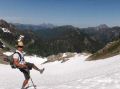
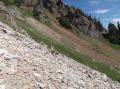
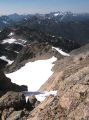
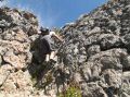
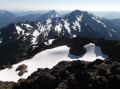
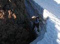
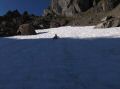
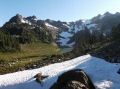
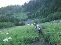
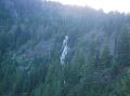
2. Upper Lena Lake to St Peter's Gate: (2.4 miles with 1150
ft elev gain):
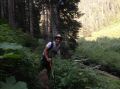
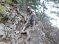
This section appeared to be the easiest but was quite tough
as we had to do some route finding and did some ups and downs on the off trails.
We arrived at a tarn above the Scout Lake that I thought the tarn
as the Scout Lake. The correct way was to hike around the tarn and
stay above the Sink Lake. Since I misunderstood the tarn as the
Scout Lake, we stayed up above the tarn and went up to the top of the ridge
gaining probably another 100 ft elev and ended up coming down back to the "resonable"
boot
trail toward the St Peter's Gate. On the flat meadow looking
at the St Peter's Gate, we took a short break and refilled our water.
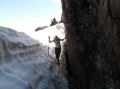
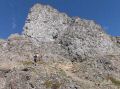
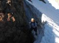
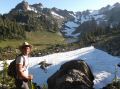
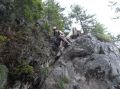
When we got near the St Peter's Gate, its gully was covered
with snow and appeared to be steep and icy. The left side was less
steep and safer. We decided to take that route. Once
we arrived at the top, we crossed over to the ridge of the St Peter's
gate to descend and go back up to the Mt Stone. We were
tired but decided to summit the Mt Stone.
|
|
|
|
|
|
|
|
|
|
|
|
|
|
|
|
|
|
|
|
|
|
|
|
|
|
|
|
|
|
|
|
|
|
|
|
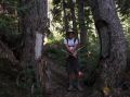
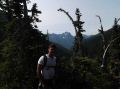
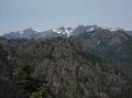
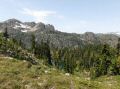
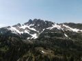
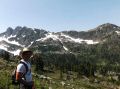
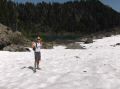
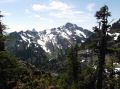
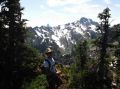
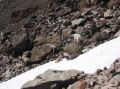
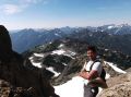
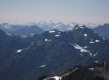
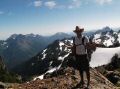
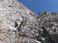
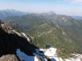
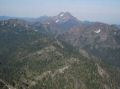
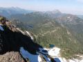
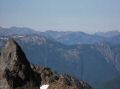
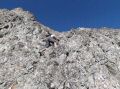
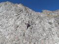
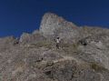
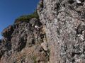
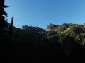
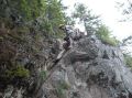
3. St Peter's Gate to Mt Stone summit (2.8 miles with 2150 ft
gain)
It was the toughest of the hike going down and back up, but we were
determined to summit the Mt Stone. We saw a family of the
mountain goats on our path, so I scared them away by throwing rocks at them
but not intending to hit them. They moved away from us. Mountain
goats are actually dangerous animals and the hikers should not be close to them.
One hiker was killed by a mountain goat on a Khahein Ridge trail back
in 2011. We saw another huge single goat in the distance while going up
the North summit of the Mt Stone. It was neat to see the Mountain
Goats but needed to be careful of their presence by keeping enough distance
at all time. We got to the Mt Stone ridge where we now could see
the summit. The summit is not visible until close to the top of the ridge.
That's where we felt like we were recharged. Rahul did
excellent scrambling up the mountain. Some of those scrambles were class
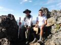
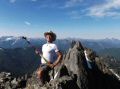
2 and maybe class 3. At the summit, we took a good break finishing
up our snacks and drank most of water.
|
|
|
|
|
|
|
|
|
|
|
|
|
|
|
|
|
|
|
|
|
|
|
|
|
|
|
|
|
|
|
|
|
|
|
|
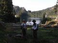
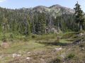
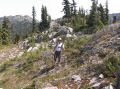
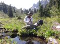
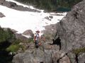
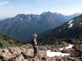
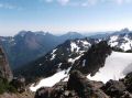
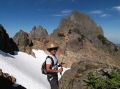
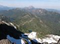
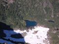
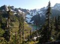
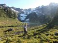
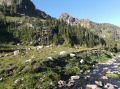
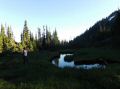
4. Mt Stone to Lake of the Angels (1.1 miles with 1500 ft elev
loss):
From the Mt Stone summit, now, we had all downhill back
to the car. Just before going over the ridge to the Lake of the Angles, we
refilled our water that was from melting snow at high elevation and clean. Rahul
had some knee pain, so I gave him a knee brace that worked great. I've
been always carrying 2 knee braces as part of 10 hiking essentials. The
trial was sort of way trail going down to the Lake but we managed to find the
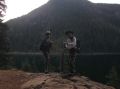
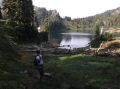
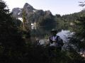
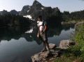
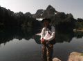
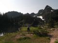
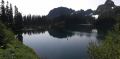
trail down to the Lake. The Lake was truly beautiful nestled between Mt Skokomish
(6434 ft elev) and Mt Stone ranges. I rate its Alpine Lake as top 3 beautiful
lakes in the Olympics so far: Lake of the Angeles, Royal Basin, &
Deception Basin.
|
|
|
|
|
|
|
|
|
|
|
|
|
|
|
|
|
|
5. To Lake of the Angels Trailhead (3.1 miles with 3500 ft elev
loss) & bike to Lena Lake Trailhead"
It was uneventful hiking down
the steep trail other than meeting a backpacking couple about 0.5 miles above
from the Road Junction as it was getting dark. It looked like they
needed to go another 1 mile or so with 2000 ft elev gain. The
lady was in really bad shape breathing pretty hard and only carrying the hiking
poles. She said it was her first backpacking trip and " it
was the worst day in her life." The amazing thing was that
the guy was carrying both backpacks (his and hers) without hiking poles (I presumed
that the lady was carrying his). He looked like a well built and a strong
guy, and said it's only "2.1 miles to the Lake from the Road Junction."
I recommended to stay overnight near the Pond of False Prophet and
do a side trip to the Lake in the morning. Hmm, I wonder
what happened to them...
|
|
|
|
|
|
|
|
|
|
|
|
|
|
|
|
|
|
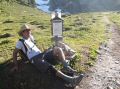
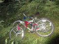
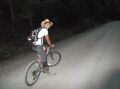
When we returned to the Lake of the Angels Trailhead, we jumped on the bikes we stashed away earlier. It was about 4.1 miles of mostly downhill bike riding to the car in the dusk and darkness. So, we hiked and biked 20.8 miles in 14.5 hours that included three 1/2 hour break. We started at 0635 and ended at 2110. We pumped (filtered) the water at Upper Lena Lake, above the Scout Lake, and below the Mt Stone. I ended up drinking about 7-8 L of water for the day. The weather was pretty nice. It was around mid 70s. No doubt that it was the toughest dayhike I've done so far. It beat dayhiking the loop of Tubal Cain Mine, Silver Lake, and Mt Townsend hike (16 miles with 5800 ft elev gain) on 14 July. Next day, I felt the sensation (some excruciating pain) on my legs, not as much pain I had after running the full Marathon back in 2004.. I nursed the legs on Sat and Sun. The good thing was that I did not have pain on my knees as I was coming down the steep and rugged Putven trail. Last year, I usually wore the knee braces coming down the steep hills due to my knee pain.
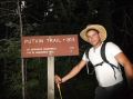
Trailhead Direction:
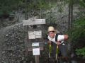
Coming from Hoodsport, just past the town of Hamma Hamma turn left at Hamma Hamma Recreational Area sign. Follow road for 8 miles past the trailhead for the Lena Lake (Lower and Upper Lena Lakes, The Brohters MT, etc). The Putvin Trailhead (for Lake of the Angles and Mt Stone climb) sign is about 4 miles pass the Lena Lake trailhead on the right.
The road to Lake of the Angeles has been repaired.