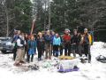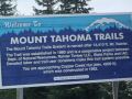
Overnighter at Copper Creek Hut (MTTA), 28-29 Jan 2012 --- 8.8 miles roundtrip with 1000 ft elev gain
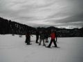
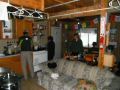
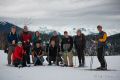
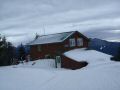
It was a fantastic overnigher with the PWC members, their friends, and my brother (James) at the Copper Creek Hut as part of the Mt Tahoma Trail Association (MTTA). The MTTA that is formed and maintaned by the volunteers. They currently maintain the Copper Creek Hut (North), the High Hut (South), and the Yurt (South) which are approximately located around the Ashford, WA., and about 7 miles short of the Paradise Visitor Center at Mt Rainier National Park (MRNP). The Snow Ball Hut which was burned down on the South district will be restored and available in 2012 winter.
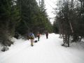
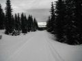
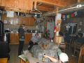
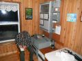
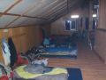
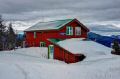
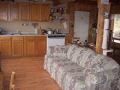
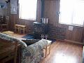
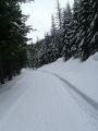
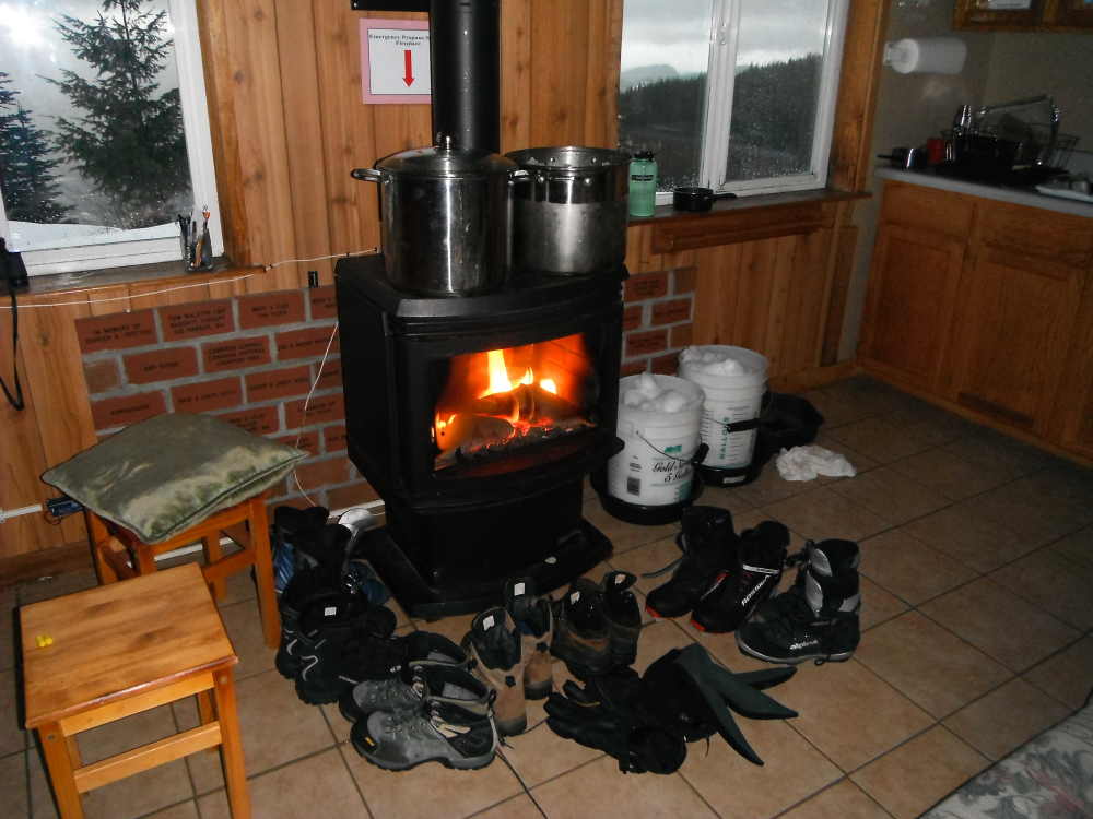
I don't usually like Winter camping but I like to spend overnight at the MTTA Huts which are the heated places at a reasonable cost of $15 per night. The only things different from an expensive resort are its lack of full electricity, hot shower, and running water. One bonus is that one can cross country (XC) ski on most of the trails at the Copper Creek Hut. Its trail for XC ski is probably rated at the medium to difficult level. It is not certainly for the beginners. Its trail is also very pleasant for strolling with friends or family members while chatting along a wide logging road.
This trip was my second time to the place. The first was with the fellow PWC members & frineds along with my son (Danny) on the Christmas Eve last year. Also, it was the first trail I ever hiked at the MRNP area. No doubt that its areas are beautiful and have lots of hiking/snowshoeing/backcountry ski areas. Hope that I can hike/backpack/snowshoe some of the trails in the Mt Rainier Area in the coming years.
Here were a brief daily summary (I did not take many pictures since I have been there before. Some of the pictures were from the trip participants):
Day 1:
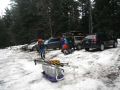
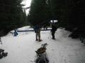
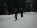
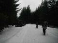
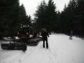
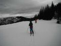
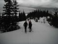
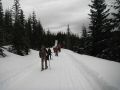
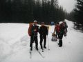
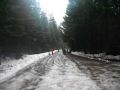
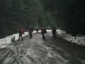
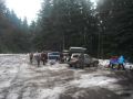
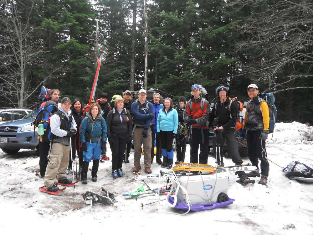
All of us hiked/snowshowed/skiied up 4.8 miles with 1000 ft elev
to the Hut. Fred and I hiked up to the Hut pulling up the snow sleds that
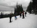
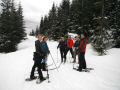
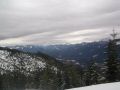
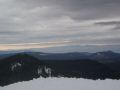
were full of food for 14 people. Then, some of us took a side trip to the Mountain
View (about 3 miles round trip with 200-300 ft elev gain). Upon hiking
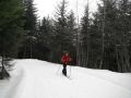
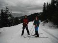
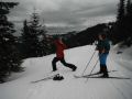
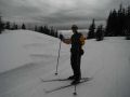
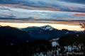
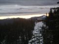
up to the Hut, I quickly put the skis on and XC skiied about 9 miles till 1700
(getting dark). It was an excellent condition for XC skiing. The
night was surprisingly warm at 40F (outside temp) at 4200 ft elev. Inside
temp at the Hut was around 70F.
Day 2:
It rained a bit through the night with some strong wind. In
the early morning, my plan was to ski from the Hut to the Puyallup Lookout Ridge
(about 12 miles roundtrip). I figured I could do it in 3 hours. Since
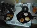
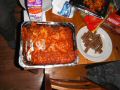
it was raining, everybody just hung out in the Hut and had a good breakfast
together like we did for the dinner. So, it worked out great.
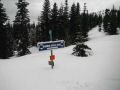
We did all the chores (cleaning, sweeping, put the things in order, etc) together at the Hut and left there around 1100 in the rain. Surprisingly, it was raining at the Hut (Elev 4200 ft). Thanksfully, the others (Craig, Mike, Jay & Fred) carried down the snow sleds while I XC skiied down. I took a few falls due to my lack of ski skill but luckily did not get hut. It was a bit harder to ski on some spots like crusty and hard crumpy snow. Pam, a veteran PWCer and an expereince skiier, taught me a half plowing technique which worked out pretty well. I went up and down a steep hill a couple more times to practice the half plowing technique that got my thighs really tired (felt burns) and had enough workout for the day.
In overall, it was an excellent trip. I want to go back to the MTTA Huts again in March (High Hut on 17-18 Mar, Copper Creek Hut on 24-25 Jan).
|
|
|
|
|
|
|
|
|
|
|
|
|
|
|
|
|
|
|
|
|
|
|
|
|
|
|
|
|
|
|
|
|
|
|
|
|
|
|
|
|
|
|
|
Pictures from Jay & Amy:
|
|
|
|
|
|
|
|
|
|
|
|
|
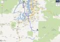
Driving Directions to the trailhead (Copper Creek Hut (MTTA)):
To get there, drive east from Tacoma on State Route 7 to Elbe and turn left onto SR 706--the Road to Paradise--and continue east toward Ashford. Just past milepost 6, turn left (north) onto Forest Road 92.
Drive up to 6 miles, passing a white Mount Rainier Lions building in the first 0.5 mile, to the lower or upper Sno-Park--depending on the snow level--at the road's end. This route is described from the upper Sno-Park. If you miss FR 92 you'll find the MTTA office near the Ashford fire station. MTTA trail/topo maps are available at the local gear shop.
BE SURE TO CARRY CHAINS and be prepared for driving forest roads in snow and ice.
Copper Creek Hut Technical:
Roundtrip 8.8 miles
Elevation Gain 1000
ft
Highest Point 4200 ft
Driving Directions (High Hut) ---- Need to VERIFY To get there, drive east from Tacoma on State Route 7 to Elbe and turn left onto SR 706--the Road to Paradise--and continue east to Ashford. At the edge of town, watch for the brown South District Access Road sign, and take the next right onto 1 Road. At the T intersection (2.8 miles from the highway), turn left at the brown sign pointing toward 1 Road. At mile 4, veer left at the fork. The first, lower Sno-Park is located at mile 6.4. If the snowline is higher, continue to the second, upper Sno-Park, staying left at 6.7 miles (following the signs to the Outer Loop Trail). The second Sno-Park is at mile 7.5.
High Hut Technical:
Roundtrip 7.8 miles
Elevation Gain 2400 ft
Highest
Point 4800 ft