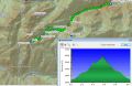
Hiking Cunningham Pass (at Tunnel Creek Divide near between Lake Constance and Mt Constance), 10.7 miles roundtrip with 3900 ft elev gain, Fri 8-2-2013
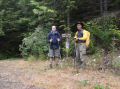
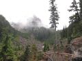
It was my 3 consecutive adventurous dayhikes on Fridays on my federal furlough or day off. This week, Charlie and I chose the Cunningham Pass since we just hiked the area (Valhallo Peak) 5 weeks ago and briefly talked about the Cunningham Pass then. Time spent was 0830-1710. The Cunningham Pass is geographically located about 2 miles West of the 5050 Pass that starts from the Tunnel Creek Trailhead. The "V" notch (Cunningham Pass) is on the north side of the basin (5400 ft elev) at about 6300 ft elev. It lies at the western end of the ridge that divides the North and South Forks of the Tunnel Creek. Above the basin in the area, there are peaks like March and April. The first half of the trail (2.7 miles) is on the 5050 Pass tunnel Creek trail. Then, the rest is on vaguely defined routes. Its game trail is briefly described on the lower portions of the Olympic Mountains Climber's Guide to Mt Constance (Route 5, SE route, page 107, 3rd edition) but its info is for the experienced hikers/climbers who have good knowledge of the area. We mostly used the information from NWhiker's website that had excellent descriptions and nice pictures.
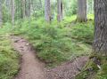
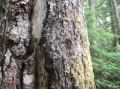
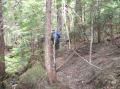
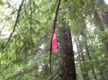
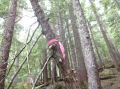
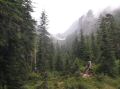
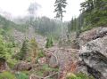
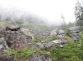
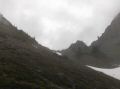
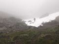
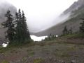
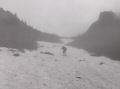
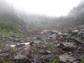
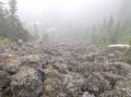
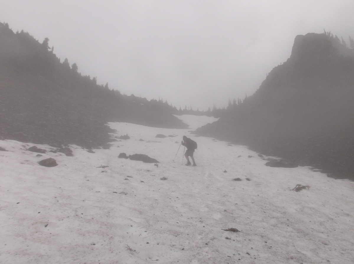
As usual on the game trails in the forest, we spent some time to navigate our ways trying to get to the Upper Basin (clear cut area). We started fine following some obnoxious notch marks on the tress and the pink flags. Then, we were way off to the North East away from the creek following the pink ribbons. DON'T FOLLOW THOSE PINK FLAGS too long. After traversing through some thick bushes toward the creek, we were able to find the mid basin (4900 ft elev) using our estimated GPS tracks. The worst thing was that we got rained on pretty much all day and think fog moved in at the upper basin. We could not see the peaks around us and needed to carefully descend the mountain safely well before the dusk. With an almost white out condition, we were not quite sure where the Cunningham Pass was. As we headed up to the upper basin, I thought that I saw the sharp V notch (Cunningham Pass) above a steep shale gulley for just once before the fog got thicker. As we got soaked, we settled to a saddle at 6000 ft elev to the West of the Cunningham Pass (Found this out when I got home) without any views !!!
Short description of its estimated route (elev and miles) using correct GPS tracks (on our ways back down) and NWHikers' information:
1. Tunnel Creek Trailhead (2480 ft elev). Established
trail. 2.7 miles to Stock Crossing.
2. Right after Stock Crossing (3700 ft elv) before the
log bridge, follow an obvious way trial.
Then, way trail started to fade. Do not follow the pink flags too long.
Follow 2-3 notch marks (blazes) on the trees.
Stay close to the creek (should be audible at all time). Navigate through
down trees to the North East if necessary but come West to stay close to the creek.
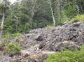
3. Arrives to Rocksides (4400 ft elev) around 3.7
miles. Over the rockslides, stay left.
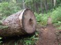
At some points, there are some steep sections but thin forest with many down big trees. Zig and zags by following
some notch marks.
Stay close and right of the creek
Near the mid Basin at 4950 ft, see some huge "Cut" trees
that lead to the small meadow and mid basin.
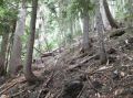
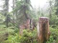
4. Arrives to Mid
Basin (4920 ft elev) at 4.2 miles. An
open area but a huge mass of fallen trees and huge boulders. Route to Upper
Basin can be tricky. Need to go around
to the left side just below a rugged sharp peak.
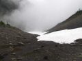
5. Upper Basin (5360 ft elev). 4.6 miles. Due to thick fog, we could
not see anything but I imagine that one should see the
Pass to the North above steep shale.
6. The Cunningham Pass is on the North side of the Basin
at about 6300 ft elev. 5.5 miles.
In overall, it was a fun and adventurous hike. Thanks to Charlie for hiking together. I would like to go back there on a nice and sunny day some time later. It would be interesting to see the terrain to the Mt Constance and Charlia Lake area. From the Pass, Lake Constance area is not visible since there is another ridge (that we climbed). Next time, I would probably aim for the 7020 ft peak that may have the views to both Lake Constance and Mt Constance areas.
|
|
|
|
|
|
|
|
|
|
|
|
|
|
|
|
|
|
|
|
|
|
|
|
|
|
|
|
|
|
|
|
Trailhead Direction:
Take US Highway 101 south from Quilcene for one mile to
Penny Creek Road. Follow the county road 1.4 miles to "Y" where
pavement ends.
Take a left onto a gravel road and go 1.3 miles to Forest
boundary, where the road becomes paved.
(Note to Notch Pass TH, about 0.8 miles into the road, there is unsigned
road to the right), Stay on paved road
#27 for 1.3 miles and turn left on FS Road #2740. (There is a road sign. Note to Marmot Pass TH and Mt
Townsend TH, Turn Right there.)
Travel on #2740 for 6.6 miles to the trailhead. (Note to Lower Big
Quilcene TH in about 2 miles).