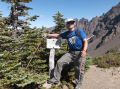
Hiking Del Monte Ridge via Heather Creek Trail (about 22 miles with 4500 ft elev gian), Sun, 9-1-2013
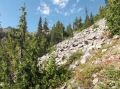
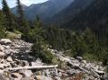
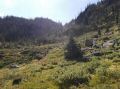
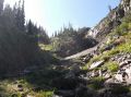
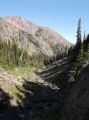
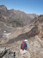
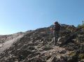
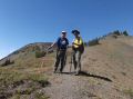
We were fortunate to accomplish another nice dayhike in NE Olympics. For the last few weeks, overcast weather has arrived in WA State. For the weekend, Sunday was the right choice for a long dayhike (< 10 hours). For our adventurous day hike for the weekend, Les and I selected a moderate hike in elevation gain so that we could recuperate on time for the Mt Constance Climb in 5 days. Our routes were Upper Dungeness Trailhead, Camp Handy, Heather Creek Trail, off trail up to the Del Monte Ridge, above Sunnybrook Meadow, Constance Pass, Home Lake, Boulder Shelter, Camp Handy, and Upper Dungeness Trailhead. For the routes, I have hiked all of the maintained trails except for connecting the end of Heather Creek Trail to Del Monte Ridge and down to the Constance Pass. It was a lot rougher connecting the end of Heather Creek trail to the Del Monte Ridge as the lower area was full of Willows Trees and thorny bushes. We thought that we went too much to SW (toward Mt Mystery) away from the valley that we needed to get on to get to the North side of the Del Monte Ridge. We ended up going to higher altitude avoiding those Willows trees (we saw cairn markings on a small rock fields, so some people were there) and turned sharp SE. Our position in my GPS indicated that we were way too much west. Les was excellent in recognizing the creeks and valleys. I estimated 3 hours to get to the Del Monte Ridge but took us 3.5 hours, so it was not horrible. It was just rough, time consuming, and agonizing with bushwhacking.
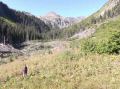
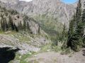
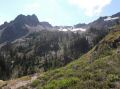
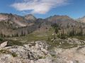
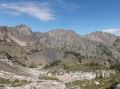
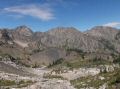
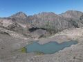
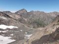
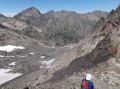
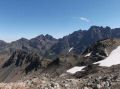
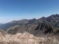
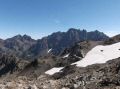
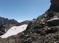
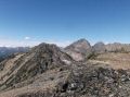
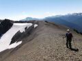
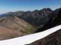
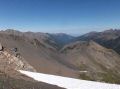
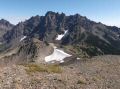
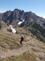
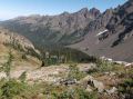
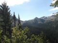
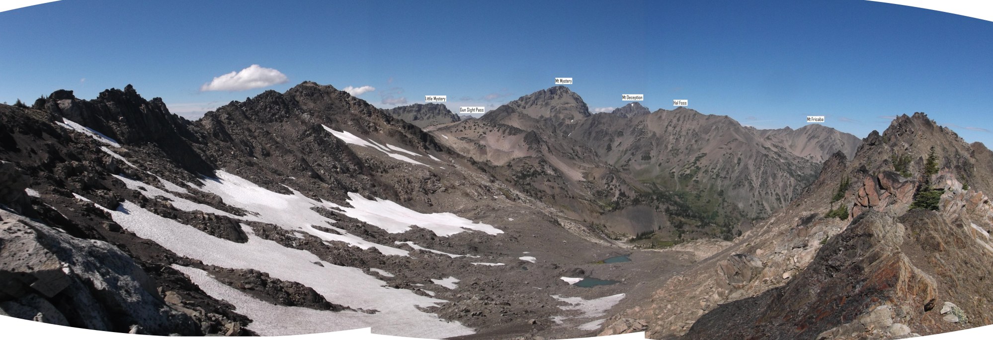
All our efforts made worthwhile when we reached the North side of the Del Monte Ridge. On the way up to the Ridge, there were neat glacial tarns in 2 separate plateaus. To the North, we could see the Little Mystery, Gun Sight Pass, Mt Mystery, Hal Foss, Mt Deception, and Mt Fricaba. When on the Del Monte Ridge at xxxx elev which wass the highest point around, we could see 360 degrees of unobstructed views of the Olympics. The ridge walk was simply spectacular and all of agonies and leg pains have temporality disappeared all at once. We looked at the Gun Sight Pass for a future trip. It looked like a straight up approach would be easy from the Sunnybrook meadow but there was ups and downs from the Del Monte Ridge.
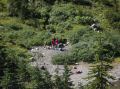
We arrived at the Home Lake around 1330 and met the PWC backpackers who just arrived from Boulder Shelter. They were doing 3 days trip from Upper Big Quilcene to Dosy Road.
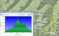
Here was a summary of our routes in miles and elevations
from my Garmin Dakota 10 GPS unit:
a. Upper Dungeness Trailhead (2600 ft
elev)
b. To end of Heather Creek (3471 ft elev, 6.3 miles. 6.3
miles total): :
c. To Del Monte Ridge (6525 ft,, 4.4 miles, 10.7 miles
total):
d. To Constance Pass (5000 ft, 1.3 miles, 12 miles total:
e. To Home Lake
(5322 ft elev, 0.4 miles miles, 12.4 miles total), :
f. Upper Dungeness Trailhead:
(2600 ft elev, 9.5 miles, 21.9 miles total.
In overall, it was a fun day in NE Olympics. it was just our fun scouting dayhike. I don't think I will do the routes with a fullpack. It was a long distance dayhike that broke my personal distance on the 2nd week in a row but was not quite tough as dayhiking the South Peak of the Brothers Mt or the Mt Walkinsaw via Gray Wolf Ridge.
Side Note (Matsutake Mushroom in bloom): I was able to harvest some Matsutake Mushrooms in the upper area of the Heather Creek Trail and just below the Boulder Shelter (3500-4000 ft elev). It's little early but they were in full season as its heads were coming out of the ground surrounded by the fir trees. Iwas 100% sure that they were Matsutake for its distinct smell and skitshirt stalk. My wife made a stir fly with oyster sauce and garlic. It was delicious.
|
|
|
|
|
|
|
|
|
|
|
|
|
|
|
|
|
|
|
|
|
|
|
|
|
|
|
|
|
|
|
|
|
|
|
|
|
|
|
|
|
|
|
|
|
Upper Dungeness Trailhead (TH), the same as the Royal Basin TH. 4 miles from here is the Tubal Cain Mine Trailhead.
a. Follow Highway 101 to Sequim Bay State Park, turn west across from the state park onto Louella Road.
b. Follow Louella Road one mile to Palo Alto Road and take a left on Palo Alto Road for 1.1 mile to the Forest Boundary.
c. The Palo Alto becomes FS Road #28. Turn right onto FS Road #2880, drive past Dungeness Forks Campground for 1 mile stay left onto FS Road #2870 for 8.7 miles to trailhead.