Bagging Multiple Peaks via Goat Lake on Royal Divide
About 12 miles with 5500 ft elev gain
)Fri, 10-25-2013)
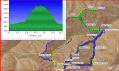
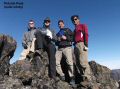
Bagging Multiple Peaks via Goat Lake on Royal Divide (a loop of Petunia Peak (6960 ft), 6998 Peak, 6763 Peak, and 6626 Peak) in NE Olympics (Time spent was 0830-1800)
Another foggy week has plagued much of Western Washington. Also, the temperature inversion has been going on close to 2 weeks. While the low lands were in 50s and foggy, the high country (over 5000 ft elev) was near 70s. Last week Fri, 4 of us had an excellent scramble-climb traversing Mt Washington to Mt Ellinor. This week, we decided to hike another nice loop hike in Upper Dungeness Area: Upper Dungeness TH, Camp Handy, Goat Lake, Petunia Peak, 6998 peak, 6763 Peak, 6626 Peak, and off-trail bushwhack along the ridge that divide Royal Creek and Dungeness River.
Back in July this year, I hiked the Goat Lake, 6998 peak, and down to Royal Basin Trail. At that time, we thought 6998 peak was the Petunia Peak (6960 ft). So, essentially, I did not summit the Petunia Peak (Class 2) before. A few hikers mentioned the loop in counterclock wise on the NWhikers Forum. We did it in clockwise and it was a lot tougher than I thouhgt on the ridgeline to intercept the junction of Royal Creek and Camp Handy. It was probably because we came down, instead of going up, on the ridge. It's a bit hard to see the easier way going down. Some of the routes (5400 ft to 2900 ft drop) were quite steep that took some time.
Trail description:
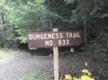
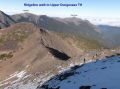
a. Upper Dungeness TH (2500 ft elev) to across Camp Handy
(3100 ft elev): about 3.2 miles. Get on
the ridge just before crossing the 2nd log bridge. It's trail is parallel to
Camp Handy trail. Well defined trail.
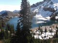
b. Across Camp Handy (3100 ft) to Goat Lake (5920
ft): 2.1 miles. Just before reaching the Camp Handy, crossed the creek using the fallen logs that
laid across the river. The key was to
stay left of the meadow heading west and
then stay right of the creek that was flowing from the Goat Lake !
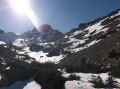
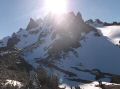
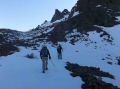
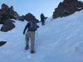
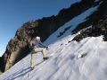
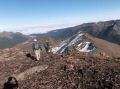
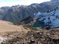
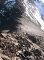
c. Goat lake (5920 ft) to Petunia Peak (5960 ft). 0.9 mile.
Near class 2 until below the Peak.
Before the summit, needed to watch out for falling rocks.
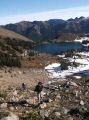
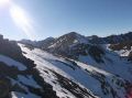
d. Petunia peak to 6998 peak. 1 miles.
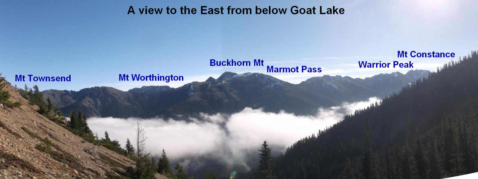
Class 2 back down to ridge. Class
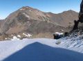
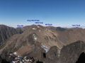
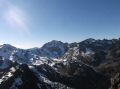
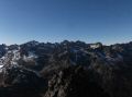
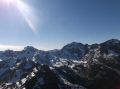
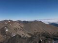
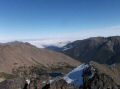
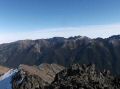
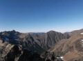
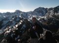
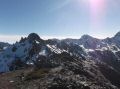
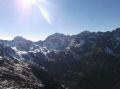
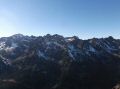
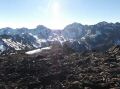
1 Ridge walk. A fantastic 360 views of the area (Gray Wolf, Mt Townsend, Buckhorn Mt, Marmot Pass, Warrior Peak, Mt
Constance, Inner Constance. ...)
e. 6998 peak to short of Junction with Royal Basin
trail. 3.6 miles. Downhill ridge walk. Bushwhacked about 2500 ft down (5400 ft to 2900
ft). Forgot to take some pictures.
f. To Upper Dungeness TH.
1.3 mile Well maintained trail.
In overall, it was an excellent (9 out of 10) dayhike in the high country in late season. The Petunia Peak was one of the best view spots in the Olympics. I do not think it's worthwhile to take the ridgeline dwon to the Upper Dungeness TH. I would prefer the counterclock wide route.
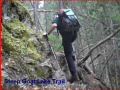
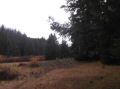
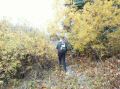
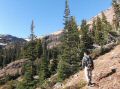
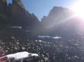
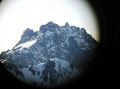
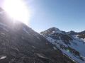
From Upper Dungness Trailhead to Petunia Peak:
|
|
|
|
|
|
|
|
|
|
|
|
|
|
|
|
|
|
|
|
|
|
|
|
|
|
|
|
|
|
|
|
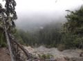
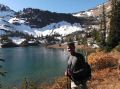
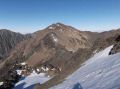
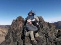
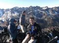
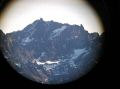
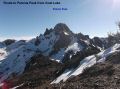
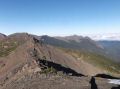
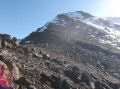
Views at the Petunia Peak:
|
|
|
|
|
|
|
|
|
|
|
|
|
|
|
|
|
|
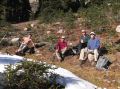
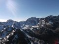
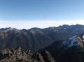
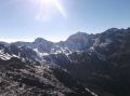
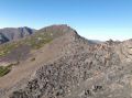
From Petunia Peak to Riidge Walk and home:
|
|
|
|
|
|
|
|
|
|
|
|
|
|
|
|
|
|
|
|