![]()
![]()
![]()
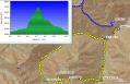
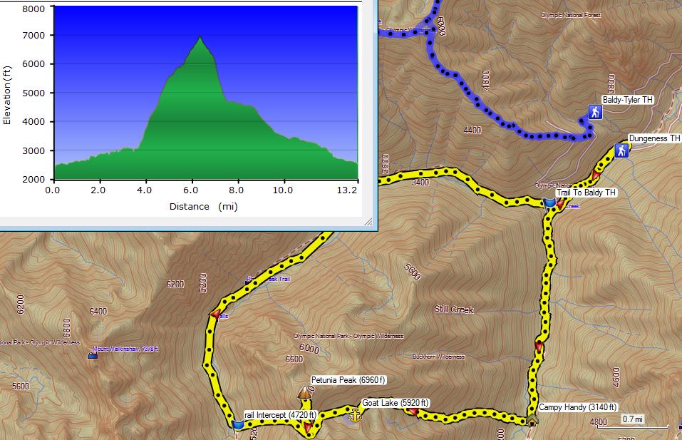
Hiking Petunia Peak (6960 ft, Beyond Goat Lake (5920 ft elev)), 13.2 miles with 4500 ft elev gain. (Fri, 19 Juley 2013)
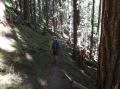
It was a nice loop hike on our federal furlough and day-off (a loop from Upper Dungeness TH, Camp Handy, way trail to Goat Lake and Petunia Peak, bushwack to intercept Royal Basin Trail, and hiked down to Upper Dungeness TH). Thanks to a PWC member, Charlie Pomfret, for sponsoring the trip. I've heard of the Goat Lake many times but this was my first time visit to the Lake. A decent weather streak in the 80s continued for the weekend.
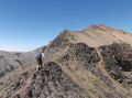
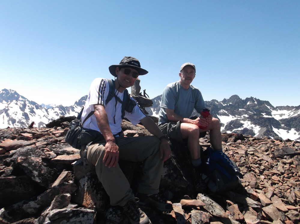
After I posted my short trip report on the PWC website, a PWC member, Craig M mentioned about the Petunia Peak hike with a few links from the NWhikers forum. One hiker did the loop solo in opposite direction in 2012 and the other hiked the same on 20 July 2013, the next day we hiked the loop !!! Reading their reports, I found out that the Petunia Peak was actually littler lower peak on the south. Charlie mentioned about this that the Climber's guide book had the Petunia Peak on the south. We actually climbed the taller peak at 6998 ft... Well, I will call the 6968 ft peak as the Petunia Peak on my trip. I think it would have been easier to the true summit (still had some snow, so need an ice axe) that we did not have to walk along the jagged ridgeline of the 6968 ft peak.
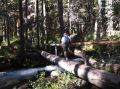
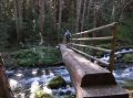
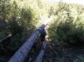
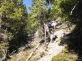
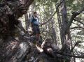
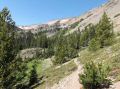
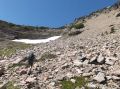
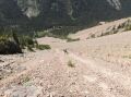
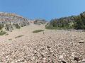
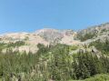
The way trail to Goat Lake was well established and appeared to be maintained by the Forest Service a long time ago. It had the sign of the "No Open Fires, Stove Only" at 3500 ft elev. A couple of places were little sketch but were easy to get back on the trail. To get on the well established Goat Lake trail, just before the Camp Handy, need to cross the creek using the lower fallen log while holding on the upper fallen log. Bushwack light-brushes to a small meadow. The key was to stay left of the meadow heading west and then stay right of the creek that is flowing from the Goat Lake ! Also the land mark is to head for the washout (dirt slope) looking at the West. Trails to the Goat Lake were quite steep (littler steeper than the Tyler Peak trail). We gained pretty much 4000 ft elev in 2 miles (Camp Handy to Petunia Peak). There was no trail to Petunia Peak which was not on the custom correct map. We went left to a notch on top of the ridge and stayed on the ridge all the way to the peak.
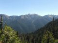
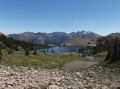
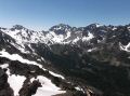
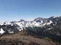
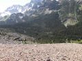
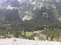
On the way to the Peak, there were excellent views to the east (Mt Townsend, Iron Mt, Buckhorn Mt, Marmot Pass, Mt Constance, the Brothers Mt, etc). And of course, spectacular views at the summit (Mt Mystery, Mt Deception, Royal Basin, Royal Lake, Mt Clark, Mt Wakinsaw, Gray Wolf peak, Mt Baldy,, Tyler Peak, & Mt Townsend in the surrounding. And Mt Baker, Glacier Peak, Mt Rainer, the Brothers in the distance.
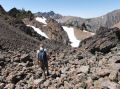
From the 6998 ft peak, we back traced near to a distinct notch, turned north (toward Royal Basin Trail) to a gentle sloped valley of the boulder field. Then, to a steep scree slope. On the way down, we took down lots of scree with us and could see the Royal Basin Trail below. Needed to head slightly left to a round rock then again head for a smaller pointy rock (Camp site below the Royal Lake II!) to intercept the Royal Basin Trail. We were too far right about 30-50 ft from the 2nd rock near the camp site and ended up fording the creek with bare feet. After crossing the creek, we continued upstream along the creek (vegetation and shrubs were too thick to bushwack) on the edge and saw the log bridge of the Royal Basin Trail. THIS LOG BRIDGE WAS WHERE THOSE NWHIERS CROSSED AND WENT UP THE SCREE FIELD.
Here is a brief summary that gives a good sense of miles
and time (we were not racing but moving steadily):
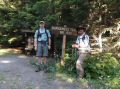
a. Upper Dungeness Trailhead (2500 ft elev): 0 miles. Left at 0840.
b.
Camp Handy (3100 ft elev): 3.2 miles
(Time 1000, 5 min break).
It's one of my favorite trails that have thundering creeks (abundant negative ions) and
rejuvenating fresh air.
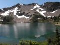
c. Goat lake (5920 ft elev):
4.8 miles (Time 1210, 20 min break). Very steep
trail. We took a good break here.
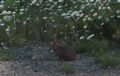
Saw a couple of big splashes on the lake.
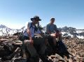
d. Petunia Peak ( 6998 ft ft elev): 5.7 miles
(Time 1320, 20 min break). No trail to the Peak.
There was a cairn marking on the summit.
e. Intercept to Royal Basin Trail 4720 ft elev): 7.5 miles
(Time 1450).
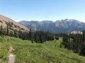
A classic and well maintained trail. Just before the junction of Royal Basin and
Heather Creek trail (1 mile from the TH),
Charlie showed me a trail (Lower Maynard Burn Trail) to Mt Baldy trail.
f.
Back to upper Dungeness Trailhead (2500 ft elev): 13.2
miles (Tijme: 1740). Stopped
by at the Longhouse and ate chicken sandwich. Its portion was just
right and delicious.
Watch out for the skeeters on the Royal Basin Trail in the upper area (4700 ft elev). I got bitten a multiple times before/after fording the creek. Although it was a short hike, it took us 9 hours of hiking time due to rough way trails from Petunia Peak to Royal Bain Trail (scree slope, avalanche rock slope (slippery), rock hoping, bush wacking, & fording a creek).
In overall, it was a nice trip. Much thanks to Charlie for sponsoring the trip. I thoroughly enjoyed the trip. It was a class I hike (in my standard) with lots of steep sections. Next time, I would love to dayhike a loop hike of Mt Baldy/Tyler Peak Trailhead, Mt Baldy, Gray Wolf Ridge, Wakinsaw, intercept Royal Basin Trail, and intercept trail to Mt Baldy TH.
|
|
|
|
|
|
|
|
|
|
|
|
|
|
|
|
|
|
|
|
|
|
|
|
|
|
|
|
|
|
|
|
|
Upper Dungeness Trailhead (TH), the same as the Royal Basin TH. 4 miles from here is the Tubal Cain Mine Trailhead.
a. Follow Highway 101 to Sequim Bay State Park, turn west across from the state park onto Louella Road.
b. Follow Louella Road one mile to Palo Alto Road and take a left on Palo Alto Road for 1.1 mile to the Forest Boundary.
c. The Palo Alto becomes FS Road #28. Turn right onto FS Road #2880, drive past Dungeness Forks Campground for 1 mile stay left onto FS Road #2870 for 8.7 miles to trailhead.