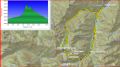
Hiking a loop of Heather Creek trail, Fricaba Pass,
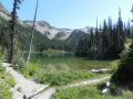
Hal Foss Peak, Deception Basin,
Deception Pass, & Royal Basin
loop.
(about 19.4 miles with 5500 ft elev gain, Friday, 73-2015)
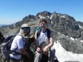
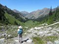
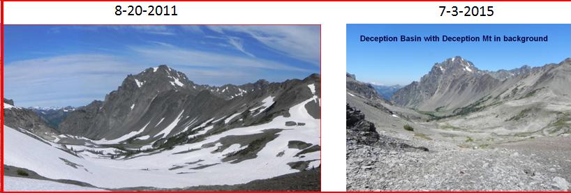
It was great to be out for a long hike for the 2nd week in a row. Barney (a PWC member) and I hiked together. Barney is a versatile athlete and a member of the mountaineers. He enjoyes hiking, backpacking, climbing mountains, kayaking, XC skiing, etc. For the last 3-4 years, we have been going to the Methow Vally together with the PWC for cross countdy skiiing. Back in 2010, 3 of PWC membes and I backpacked its similar routes, so I was somewhat familiar with the area. It's been the hottest June in history in WA State (averaged 78.9F. Previous record was 75.8F in 1992. And the most days with Temp above 90F (10 days)) and the hottest summer so far for me in 9 years in WA State. Comparing the pictures of the Deception Basin I took back in Aug 2010 and this hike, there were huge differences with the amount of snow in the basins and mountains. Basically, most of snow have melted out in the routes. We were exposed to the Sun about 1/3 of the route but there were some breeze pretty much. Alas, I felt really fatigue hiking down just below the Royal Lake. My quads were sore but kept walking in steady phase. Its hiking spec turned out to be 19.3 miles with 5500 ft elev gain per my Garmin GPS. Interestingly, I recovered in 3 days. By Tue, I was ready to hike again !
Here was a summary of the hike:
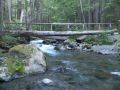
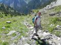
a. Upper Dungeness
TH (2600 ft elev) to a log bridge (2720 ft elev). At 1 mile, it forks to Camp Handy to the left crossing a
log bridge and to straight to the Royal Basin.
b. To Camp Handy
(3120 ft elev).
c. To Junction of Boulder Shelter and Heather Creek
Trail.
d. To end of
Heather Creek trail (3520 ft elev, 5.7 miles).
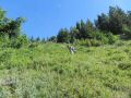
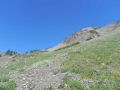
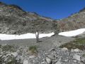
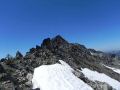
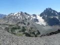
e. To Fricaba pass
(off trail, 6480ft elev, 8.4 miles). Started
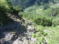
bush whacks in the beginning, then got steep with many marmot holes. Continue
stay right. If went left, going to creek and rocky cliffs !
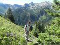
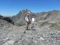
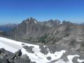
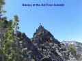
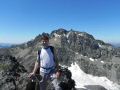
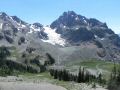
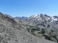
f. To Hal Foss
Peak (off trail, 7179 ft elev, 9.26 miles). Up to Class 2. We looked at the Mt Mystery and decided not
to go beyond.
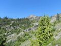
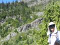
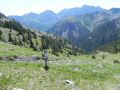
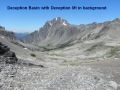
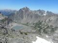
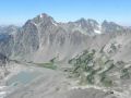
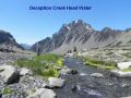
g. To Deception
Basin (off trail,6120 ft elev, 10 miles). Instead of going
back to Fricaba Pass, we opted to go
down straight to Deception Pass. It
was a lot easier.
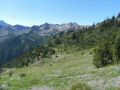
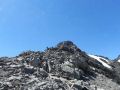
h. To Deception
Pass (off trail, 6680 ft elev, 10.7 miles). I overshot the Pass
to the left. We had to go back down
about 200 ft and came back up to the 2nd V saddle.
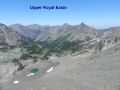
i. To Upper Royal
Basin (off trail, 6040 ft elev)).
j. To Upper
Dungeness Trailhead (2600 ft elev, 19.4 miles).
After this hike, I gained some confidence on my physical condition. I hope that I can continue dayhiking for a few more weeks which will help me for backpacking. This year, I would like to backpack the Lacrosse Basin (for 5 days) and the Bailey Range Traverse (for 7-8 days) if I can find a partner or two.
|
|
|
|
|
|
|
|
|
|
|
|
|
|
|
|
|
|
|
|
|
|
|
|
|
|
|
|
|
|
|
|
|
|
|
|
|
|
|
|
|
|
|
|
|