Isaac's Journey
Home Page
Hiking up/Glissading down the Mt St Helens & a side trip
to Ape Cave (11-12 June 2011)
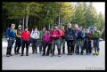
The trip was a Peninsular Wilderness Club (PWC) event
co-sponsored by Jay Thompson and Doug Savage. It was my first hike to Mt St
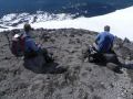
Helen and always glad to be a PWC member. Before hiking up the mountain, I was
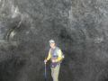
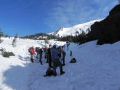
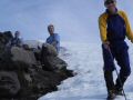
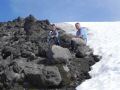
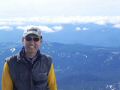
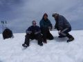
taking a group photo but my camera battery died (used too many flashes on the
1st day hike). So, Jay took a group photo. For the pictures, I had spare
batteries but not too many pictures of the PWC members since we were on
different day-hiking paces to the summit (Volcanic Rim).
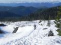
 copy/1 Mt St Helens.jpg)
 copy/Mt St Helens track.jpg)
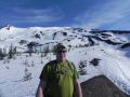
 copy/DSCN3477.JPG)
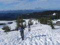
 copy/3 DSCN3480a.jpg)
What an exciting weekend again after a disappointing
week of not climbing Mt Constance due to its delayed schedule from 6-8 June to
8-10 June ! Congratulation to the PWC climbers who safely attempted the Mt
Constance summit. I could not make the climb because I had to attend my son's
graduation.
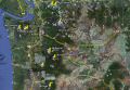
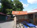
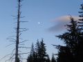
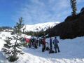
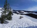
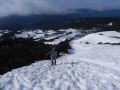
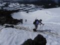
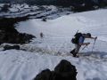
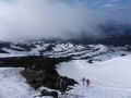
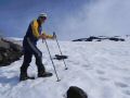
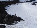
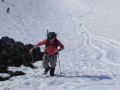
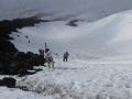
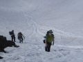
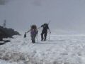
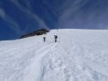
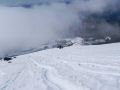
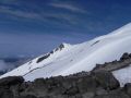
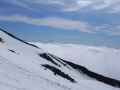
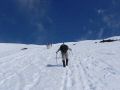
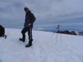
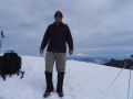
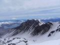
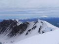
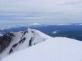
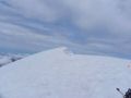
Hiking up Mt St Helen (8385 ft elev) was tough that
required good physical condition. After reaching about 4500 ft elevation,
tenacious and short tedious steps following the boot tracks on a stright up
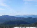
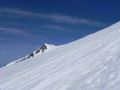
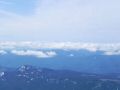
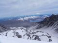
steep hill finally took the hiker to the volcanic rim ! At the rim, we were
rewarded with expensive & spectacular views of the graciated crater rim (could
not go close due to snow cornice on the rim), Mt Rainier, Mt Adams, and Mt
Hood. It was estimated 12 miles round trip with 5700 elev gain, probably the
most elevation gain I've ever had during dayhiking or backpacking. Yes, I
called the trip a HIKE since a hiker could reach the top without scrambling or
technical climbing skills. Also, no snowshoes or crampons was used. However,
we did use an ice axe as we glissaded down about 4000 ft elevation to control
speed or self-resuce (stopping from too much speed).
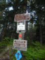
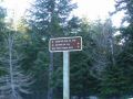
It appears that there are two routes: one summer route
at Climbers' Bivouac (9 miles with 4700 ft elev gain) and the other winter route
at Marble Mountain Sno-Park (12 miles with 5700 ft elev gain) parking area. The
Sno-Park is geographically about 1 mile south of the Climbers' Bivouac. The
Climbers' Bivouac area (also for the summer climb) which was at a higher
elevation was closed due to too much snow on the access road.
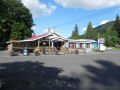
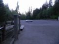
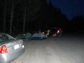
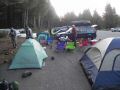
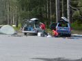
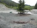
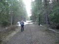
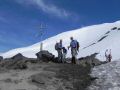
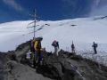
Day 1:
a. Most of the hikers gathered at Doug's house and
carpooled togeter to the basecamp on Saturday afternoon. It was about 130 miles
and 4.5 hours of driving (including rest stops) from Bermerton, WA. Left
Bremerton at time 1400, made a couple of rest stops, and arrived at the parking
lot (basecamp) at time 1830.
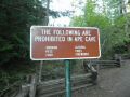
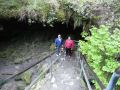
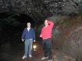
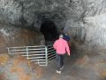
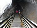
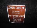
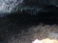
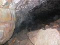
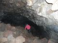
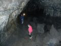
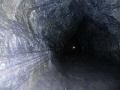
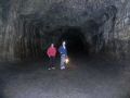
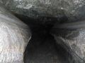
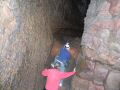
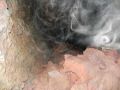
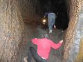
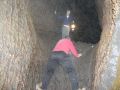
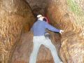
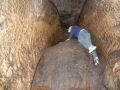
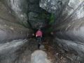
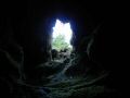
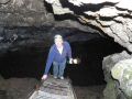
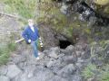
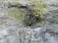
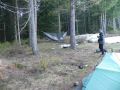
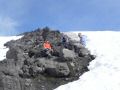
b. Jay, Paul, and I took a side trip to the upper Ape
cave (2.5 miles roundtrip (1.5 miles one way & 1 mile back)). It was noted as
the longest lava tube cave in Continental United States. There are lower (0.75
miles one way & easy) and upper caves (1.5 miles one way & difficult). We
walked through the upper cave. We had the cave all by ourselves and took about
2 hours. It was rated as "Difficult" because one needs to navigate and scamble
up some huge rocks and walls. It was an awesome and a highlight for the day.
Thanks a lot, Jay, for taking me there.
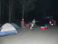
c. We returned to the camp close to 2100, and went bed
about 2330.
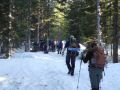
Day 2:
a. Woke up at 0500 to a nice day after 3 good hours of
sleep.
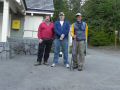
b. Started hiking up the mountain at 0630. 3 of us
(Bob, Jason, & I) summitted at 1130. Left the summit 1200 and glissaded down
(4000 ft elevation) and hiked to the basecamp arriving at 1430. The others
finished about 1600. Gllisading was not that great compared to the Brothers Mt
gllisade as we were not sliding quite well, maybe, the snow condition was not
right or the hill was not steep enough. Everybody returned safely. What a
great and tough day we had !
c. Climbing permit for each person was $22 (1 April -
31 October). Free during 31 March - 1 November. A forest car pass is required
at the basecamp site.
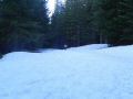
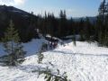
Hiking the mountain Summary:
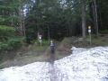
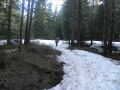
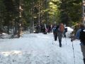
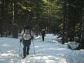
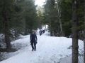
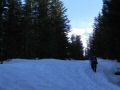
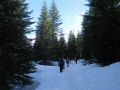
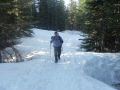
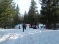
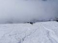
0-3 miles: Hiked through the sno-park and dense forest
with gentle slope. I was hoping to find an intersection of the Loowit trail
junction but did not see the sign. I think it's sign is at the Climbers'
Bivouac route.
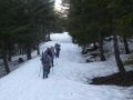
3.5 miles: Broke out into the open above the treeline.
Followed the pole markers.
3.5-6 miles: Estimated at 4500 elev. Almost straight
up to the volcanic rim.
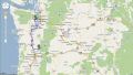
Background on Mt St Helens:
Mt St Helens is located at southeastern edge of the
Washington State. The mountain is famous for its catastrophic eruption on 18
May 1980, which killed 57 people. Its summit was reduced from 9677 ft to 8365
ft with a 1 mile wide horseshoe-shaped crater. The Mt St. Helens National
Volcanic Monument was created to preserve the volcano and allow for its
aftermath to be scientifically studied. The mountain is located 96 miles south
of Seattle and 50 miles Northeast of Portland Oregon. Its name is after the
British diplomat Load St Helens, a friend of explorer British Captain George
Vancouver who named various places like Puget Sound (his lieutenant, Peter
Puget), Mt Hood (his lieutenant William Broughton named after Admiral Samuel
Hood). Mt Rainier (his close friend, Rear Admiral Peter Rainier), Mt Baker (his
third lieutenant was Joseph Baker), etc.
Loowit trail is a trail circumference the Mt St Helens
that ranges 28 miles with 4100 ft elev gain. I want to hike this trail someday
with 2-3 days of backpacking.
Back to Isaac's
Journey Home Page